

ICELAND 11 days
This trip follows Iceland’s Ring Road from Reykjavik. It heads north to the fishing village of Siglufjörður on the Tröllaskagi Peninsula, then to the powerful Goðafoss, Dettifoss, and Selfoss waterfalls. You’ll see the geothermal landscapes of Lake Mývatn and visit remote puffin colonies at Borgarfjörður Eystri.
Moving south, the scenery shifts to the dramatic Jökulsárlón Glacier Lagoon and the rugged peaks of Skaftafell. After strolling the obsidian sands of Vík’s black sand beaches, the tour concludes with the iconic "Golden Circle" sights—Gullfoss, the erupting geysers, and a soak in the Blue Lagoon.
As the most sparsely populated country in Europe, Iceland offers a vast, untouched wilderness. Despite its location just outside the Arctic Circle, the Gulf Stream maintains a temperate climate across its plateau of lava fields and glaciers. Roughly the size of Kentucky or Tennessee, this Nordic island remains one of the most geologically active and visually stunning places on Earth.
<Scroll down to the bottom of the page to view the Photo Gallery>

🇮🇸 Essential Tips:
🚫 Don’t Stay Put: Do NOT make Reykjavik your home base. To truly see Iceland, drive around the island.
Freedom to Roam: A car rental is essential for the freedom to venture off the beaten path.
Currency & Costs: Currency is the Icelandic Króna (ISK). Expect higher prices for goods & services than in most countries.
Safety Apps: Download 112 Iceland (Emergency Services) and AllTrails (for trekking).
The Gear: Weather is unpredictable. Always carry wind and water-resistant outerwear.
Windproof pants are a "must-have" for hikers.
Weather Updates: Monitor the Icelandic Meteorological Office and Belgingur for real-time forecasts.
📖 Travel Guides: Fodor’s Iceland and Lonely Planet Iceland.
🌋Safetravel.is: check for the latest updates on any volcanic activity and trail closures before heading out.


Map of Reykjavik
DAY 1.
Arrive at Keflavik airport.
Proceed to the car rental pickup and transfer to your hotel.
Enjoy Reykjavik for the rest of your day. Downtown is small and easy to walk. Stroll down busy Laugavegur Street to browse shops and restaurants.
Reykjavík is known for great food and lively nightlife. Breweries are everywhere, and the craft beer is great.
Overnight: Reykjavik
Distance: Airport ---> Reykjavik, 40 minutes
DAY 2.
ℹ️ Route 1, The Ring Road is Iceland's primary highway.
The interior is uninhabitable, so Route 1 follows the coast to link the main sights and towns.
Drive the Ring Road (Route 1) into northern Iceland to the scenic town of Siglufjörður.
↗️ Directions: head northeast on (Hwy 1) Ring Road. For less traveledrs and dramatic ocean views
to Siglufjorour—we suggest taking Route 76 to the north.
Siglufjörður, a historic herring-fishing village, is located on the Trollaskagi Peninsula. It sits in a narrow fjord with picturesque views.
The village is known for its hiking trails, stunning scenery, and opportunities for horse-riding activities amidst the steep mountains.The option to spend an extra day in the region is worthwhile.
Overnight: Siglufjorour
Distance:
Reykjavik ---> Siglufjorour. 5 hrs. / 335 km.
Siglufjorour ---> Akureyri. 1 hour
DAYS 3 and 4.
Drive toward Akureyri.
TRAVEL TIP: Akureyri is referred to as Iceland's second city. It is an excellent spot to stock up on supplies.
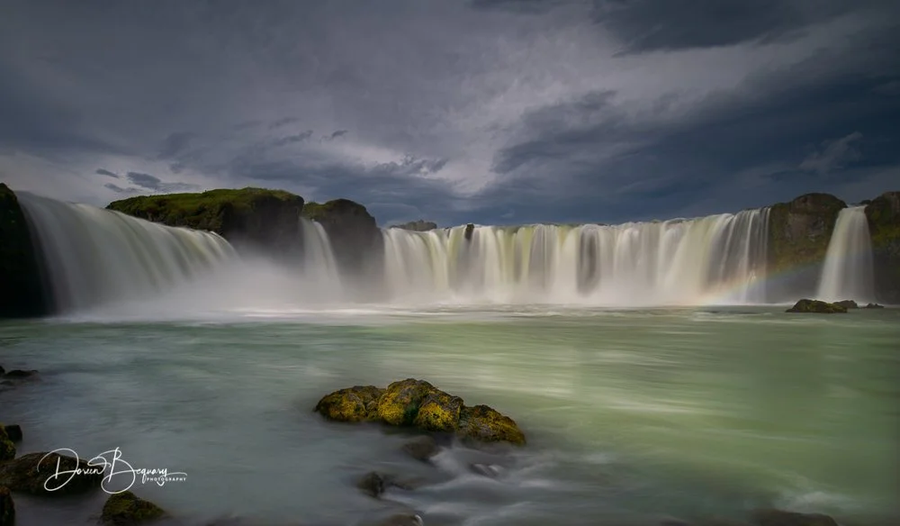
Visit Godafoss Waterfall. Explore one of Iceland’s most photographed waterfalls. [location]
From the parking lot, trails lead to several viewpoints overlooking the waterfall.
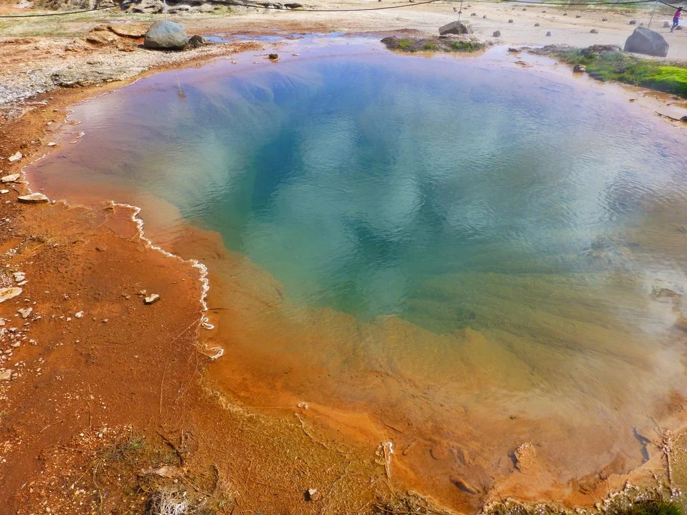
Continue (1.5 hrs.) to the Lake Myvatn region. The lake was created by lava eruptions 2300 years ago.
The area is a geothermal playground of pseudocraters, lava fields, mud pools, and natural hot baths.
Overnight: Reykjahlio.
Distance: Akureyri ---> Lake Myvatn, 2hrs.

Lake Myvatn
A beautiful lake region with incredible geological features.

Hiking at Lake Myvatn.
Few places on Earth feature such stunning landscapes and diversity.

Walk the Krafla Caldera
Don’t miss the Leirhnjukur trail nearby. The trails are suitable for all ages.

Hike Namaskard Geothermal Field
A Mars landscape with sulfurous mud pits and steam vents.

It is a 90-minute walk with a stunning view of Lake Myvatn.

Wander around Dimmuborgir
Stroll around an area of weird lava formations.
DAY 5. Thunderous Falls and the Hidden Fjord.
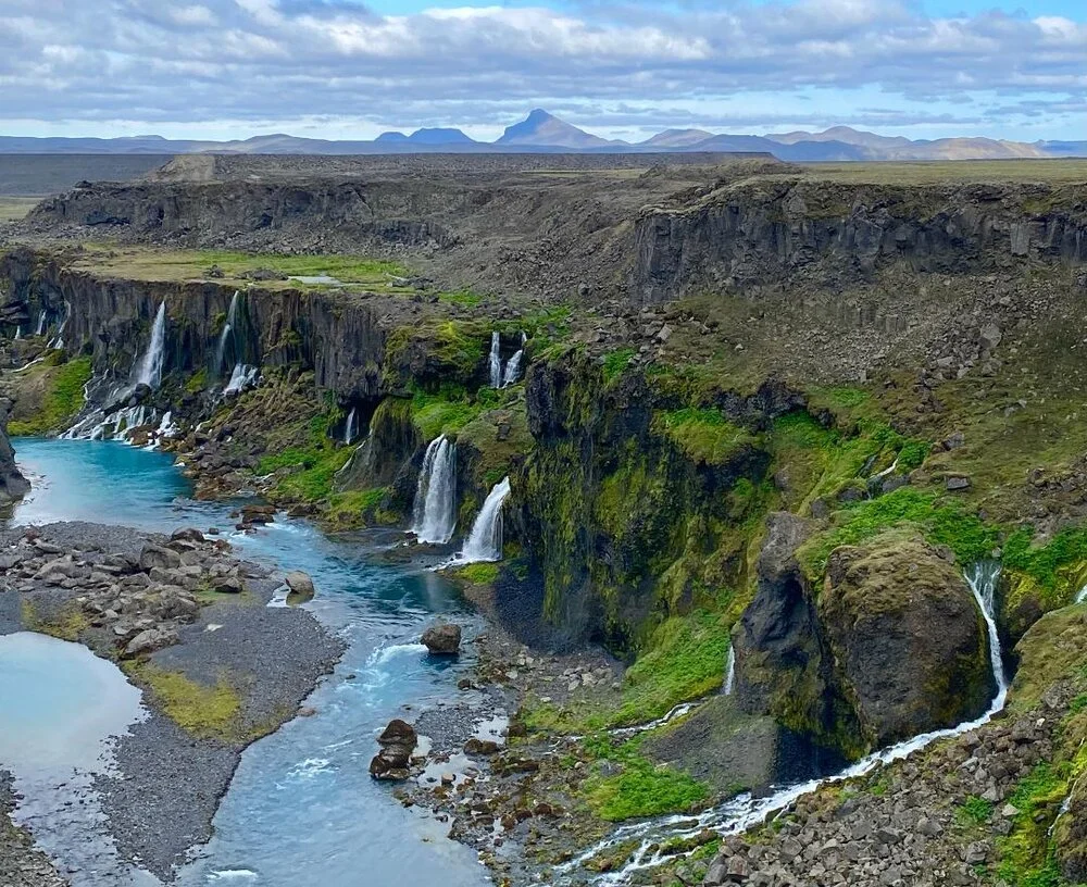
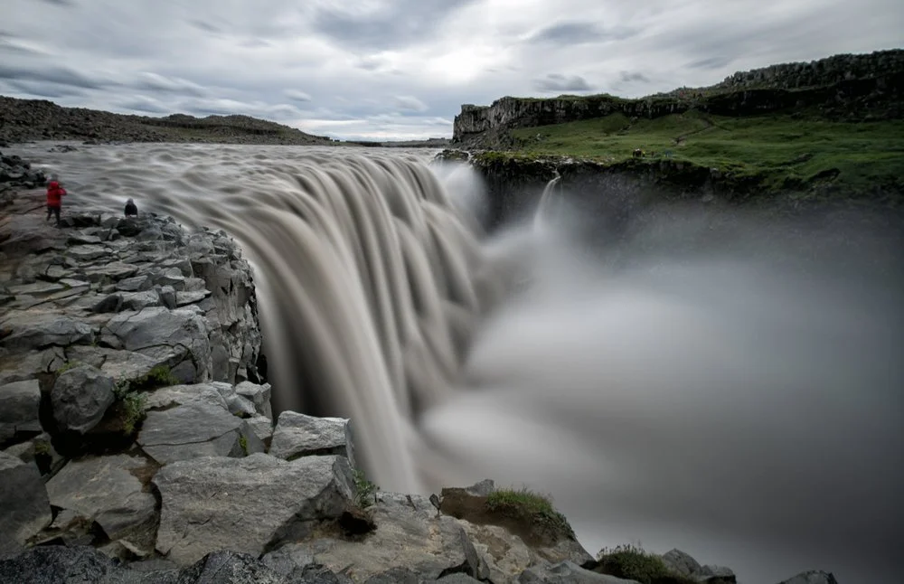
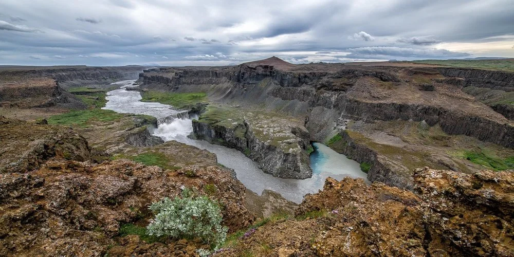
Discover Dettifoss and Selfoss waterfalls. Dettifoss has the largest water flow in Europe.
Dettifoss and Selfoss are within walking distance of each other, 2 km (1 mi.) apart.
These two (2) waterfalls can be approached from (2) different sides of the Ring Road. (Route 1.)
From the West side, take Route 862, and from the East side, take Route 864 (gravel). [Map]
📌 The East side has better views. [View trail details]
Afterward, drive to the charming, picturesque fishing town of Seydisfjordur. A remote village on a fjord where you can still
get a snow squall in summer as storms blow down from the mountains.Overnight: Seydisfjordur [Where to stay]
Distance:
Lake Myvatn ---> Dettifoss Waterfall, 1.5 hrs.
Dettifoss ---> Seydisfjordur, 2.5 hrs.

DAY 6. Fjords, Puffins, and the Long Coast Road.
During the summer, Seydisfjordur offers numerous outdoor activities, ranging from hiking and biking to sailing.
Best Seydisfjordur hike (on a clear day):
Mount Bjólfur is a 10 km (6.4 mi.) moderately trafficked in and out trail with breathtaking views. Rated: moderate.
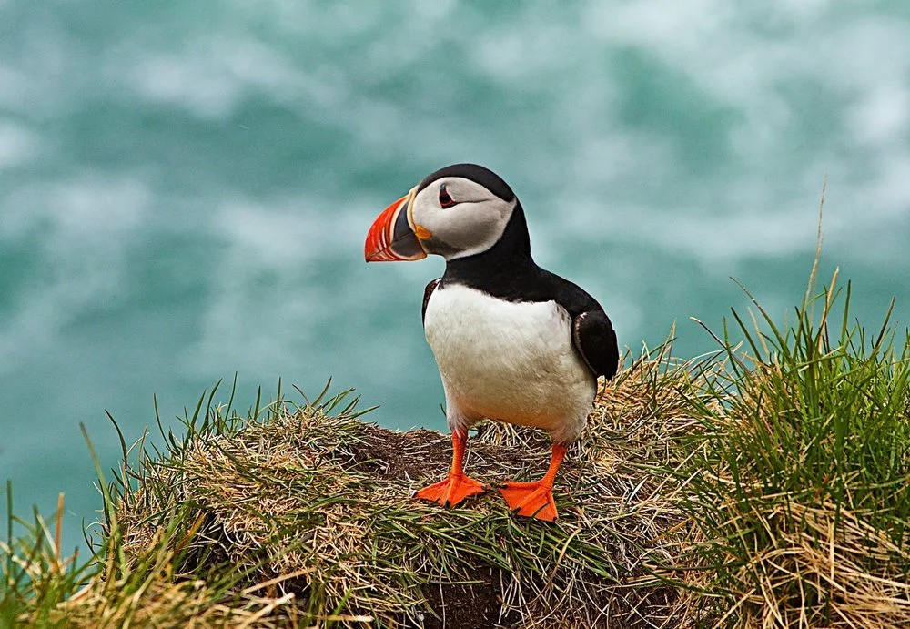
DIVERSION: add an extra day, visit the Borgarfjordur Eystri area where a colony of puffins resides.
Borgarfjörður eystri is a short, wide fjord famous for large Atlantic puffin colonies and scenic beauty.
The small, picturesque seaside village of Bakkagerði is one of the most unique villages in Iceland.
Getting to the puffin colony: Take Route 94 north to the end of the road (past Bakkagerði). View puffins on a wooden platform.
Next stop: the small fishing town of Hofn. Many visitors agree that the best breathtaking views are on the Ring Road (Route 1) in
this region of Iceland.Overnight: Hofn
Distance:
Seydisfjordur --> Borgarfjordur Eystri, 1.5 hrs.
Borgarfjordur Eystri --> Hofn, 3 hrs.
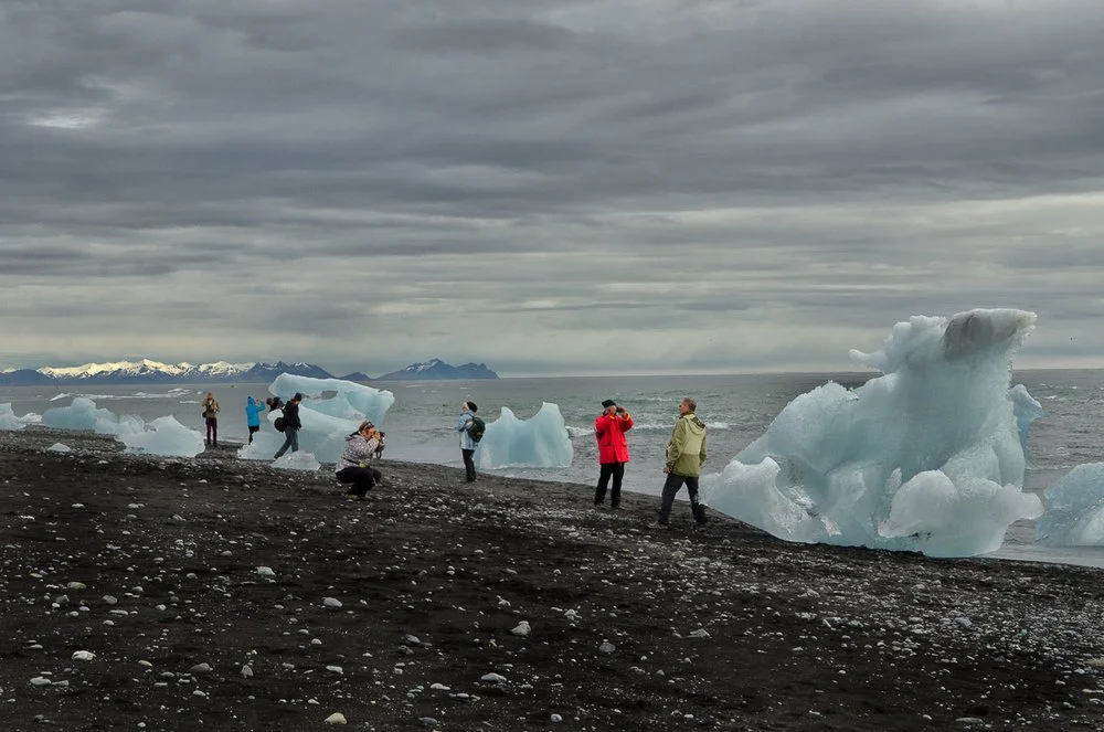
DAY 7. Blue Ice Lagoons and Glacial Caves.
Embark on Jokulsarlon Icebergs. It lies on the Ring Road (Route 1) between Höfn and Skaftafell, so travelers can reach it easily.
Jökulsárlón is a lagoon formed by meltwater from the Breiðamerkurjökull glacier. It’s full of striking icebergs in various sizes and shapes.
From the Jökulsárlón parking lot, an easy, flat 7 km round-trip trail offers great views of the icebergs.
It’s a popular photo spot where many blue icebergs drift from a glacier onto a black beach. [trail details]
Boat tours are also available to bring you closer to the iceberg maze
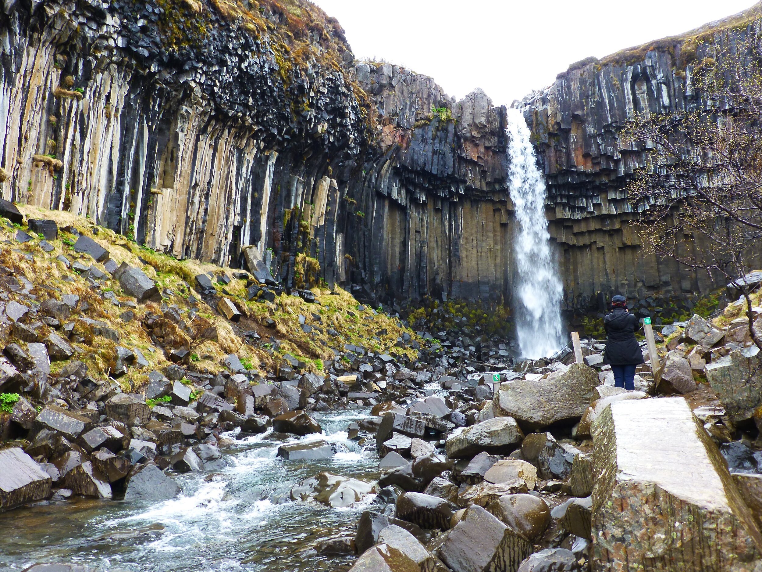
Hike to Svaftifoss
A unique waterfall with basalt columns. [View trail details]
Distance: 5.5 km (round-trip)
Walking time: 2 hrs.
Route difficulty: Easy
Afterward, drive (1 hour) to Skaftafell National Park. [map]
Skaftafell Park has several hiking trails/walking tours to see the glaciers.
A highlight is the Ice Cave tour. [video]Available: September to April [tours]
Overnight: Kirkjubaejarklaustur.
Distance:
Hofn —> Jokulsarlon Icebergs. 1 hr.
Jokulsarlon Icebergs ---> Svaftifoss waterfall. 1 hr.
Svaftifoss waterfall ---> Kirkjubaejarklaustur. 1 hr.
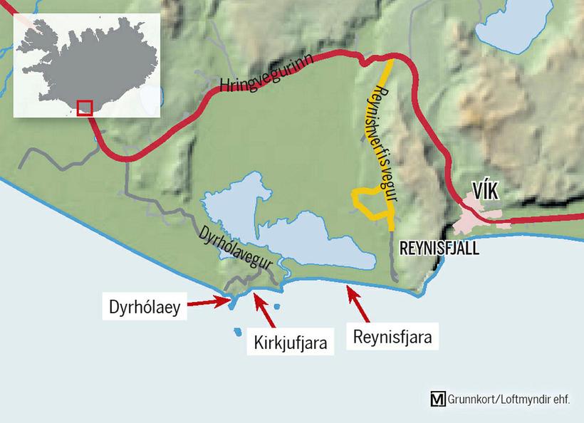
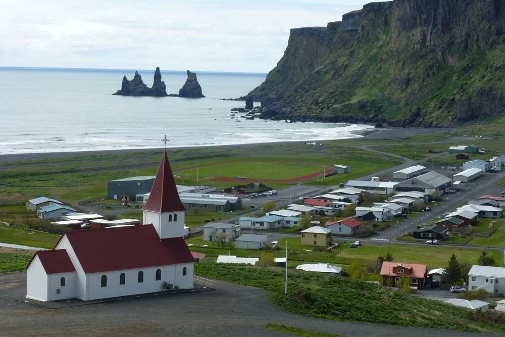
DAY 8, Black Sands & Hidden Waterfalls
Spend a captivating day touring the charming town of Vík, famous for its beautiful nature.
Stop at Dyrholaey, a magnificent natural arch located on the coast, offering great photo opportunities.
For a tranquil experience, visit Reynkjafjara Black Beach. The beach’s black sand and high cliffs create a dramatic scene. You can enjoy easy walks on the cliff paths.
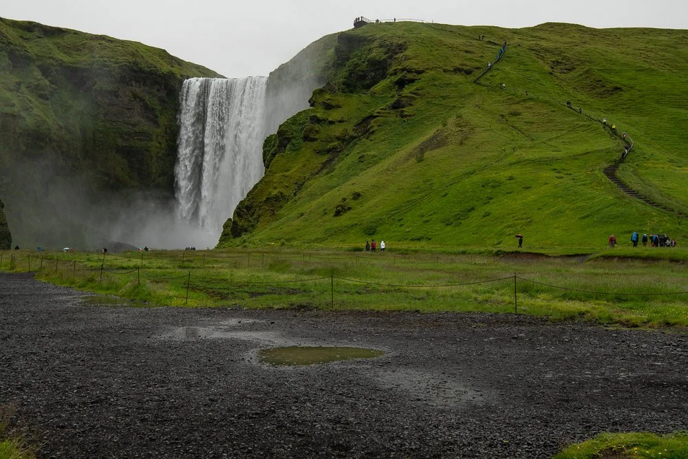
Nearby is Skogarfoss Waterfall, one of the largest and most elegant waterfalls in Iceland. There is a staircase (428 steps) to the top for amazing views. [video]
Fimmvörðuhals trail - a spectacular hike behind Skógafoss waterfall. Allow 2 hrs. The trail is a scenic parade of waterfalls. Just do it! [Gallery]
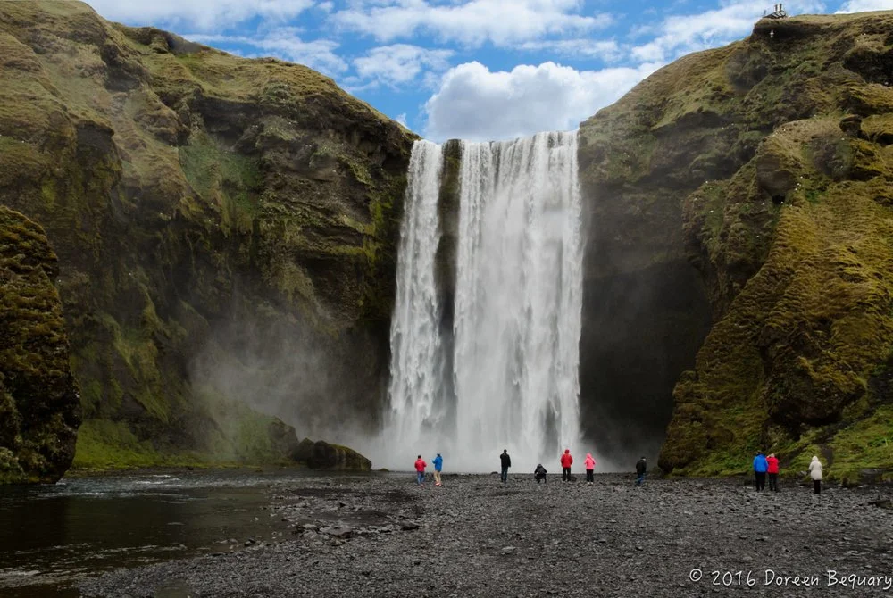
The final stop is Seljalandsfoss Waterfall. This unique waterfall (wet & slippery) appears on the cover picture of many Iceland Travel Guides.
—Why is the waterfall special? It’s the only waterfall that you can walk BEHIND.
Overnight: Fludir area.
Distance:
Kirkjubaejarklaustur ---> Vik, 1 hr.
Vik ---> Fludir. 2 hrs.
DAY 9
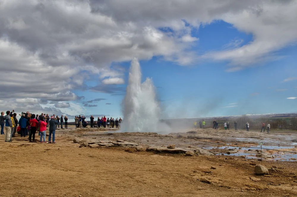
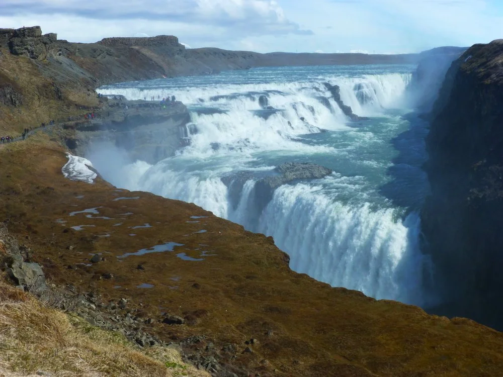
Depart from Fludir to the Gullfoss Waterfall.
Today's itinerary covers the renowned "Golden Circle Tour," a popular excursion among travelers.
Afterward, if time permits, stop at Thingvellir National Park before heading to Reykjavik. [map] The park lies in a rift valley formed
by two tectonic plates pulling apart, with rocky cliffs and cracks. Þingvellir is the only place on Earth where you can see tectonic plates
above ground. Diving tours offered.Overnight: Reykjavik
Distance: Fludir ---> Reykjavik, 1.5 hrs.
DAY 10
On your last day in Iceland, stop at the Blue Lagoon, a geothermal spa in a lava field near Keflavík airport. Its warm, mineral-rich waters—full of silica and sulfur—are said to be good for the skin.
The Blue Lagoon also has an R&D facility searching for treatments for skin conditions. 1990s studies showed the lagoon's water helped psoriasis.
When you visit the Blue Lagoon, expect bathing and swimming water temperatures averaging around 37–39 °C (99–102 °F).
Afterward, spend the rest of the day enjoying vibrant Reykjavik.
Overnight: Reykjavik
DAY 11.
End of your adventure. Return home.

F-Roads generally open June 15 - Sept 15
F-roads in Iceland are mountain roads, unpaved gravel tracks.
Prefixed with an F, such as F210, they have large potholes, many ruts, or boulders on their surface.
Under NO circumstances should you attempt driving the F-roads to Landmannalaugar in a compact rental car.
A 4x4 car is a must!
Before you rent the vehicle, make sure that taking the rental car on the F-Roads is allowed.


-
1. When is daylight in Iceland?
From mid-May to mid-August the sun only sets for only a few hours per day, and it is effectively light for the whole 24-hour period. This phenomenon is known as the "midnight sun" and it creates a sort of lingering twilight in the nighttime hours.2. How should I drive in Iceland?
Driving is the most popular way of getting around for visitors in Iceland, and the roads are generally safe for attentive drivers. Just like the USA, driving is on the right side of the road.3. What kind of monetary unit does Iceland have?
The Icelandic monetary unit is the króna and is usually abbreviated as ISK or kr.4. What is the tipping policy in Iceland?
Service and VAT are invariably included in prices in Iceland and tipping is never required. However, if you are very pleased with the service, Icelanders are generally not offended if they are offered tips.5. What are Icelanders like?
Well educated, proficient in speaking English, sophisticated dressers, modern, reserved, friendly, creative, relaxed and generally helpful to tourists.6. What kind of electrical outlet is used in Iceland?
Icelandic electrical standards are the same as other Northern European countries (50Hz, 240 volts) so North American electrical devices will require converters and/or adapters.7. What is the travel visa policy in Iceland?
Citizens from USA and Canada do not require visas.8. Can I Snowmobile? go Caving ?
Iceland is a excellent place for both activities in winter. We suggest Extreme Iceland tours.
9. When is the best time to see the Northern Lights ?
Best time is late September to late March.
10. Is Iceland safe ?
Iceland is one of the safest countries in the world. Crime is extremely low and medical care is excellent.

Search for your hotel


Average cost:
(EXCLUDING AIRFARE)
$$$ USD for two (2)people
Budget: $5,600
Moderate: $6,800
Luxury: $7,600 +

Check out where you can observe this natural phenomenon.
December through March is the best time .

🌤️ Climate
When is the best time to go to Iceland? Mid-June to mid-September.
Per Year, Reykjavik has 225 precipitation days.
The warmest months are June, July, and August.
The coldest months are November through February
October is the wettest month. May is the driest.
There are approximately 20 hours of daylight during months of June and July
Aurora Borealis (Northern Lights map) is visible from October to mid - March.
Iceland Gallery
Video


Fimmvorduhal Gallery
The popular route across Fimmvörðuháls lies between two (2) glaciers, Eyjafjallajökull and Mýrdalsjökull, and connects Skógar to Þórsmörk. The trail passes by 20 waterfalls to a grassy tundra. The best season is late June - early September.
The hike starts by heading up the stairs on the left side of the waterfall-Skógafoss. <map>
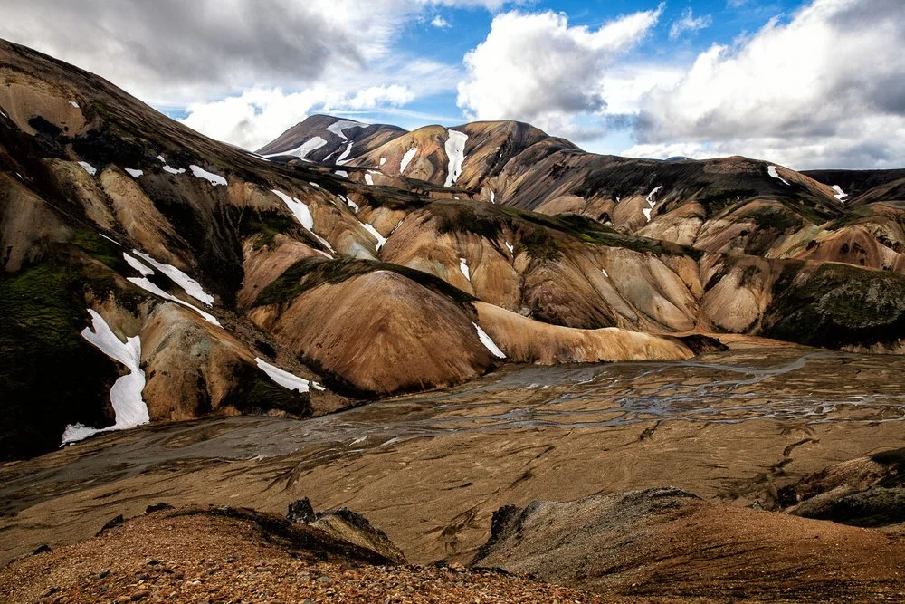
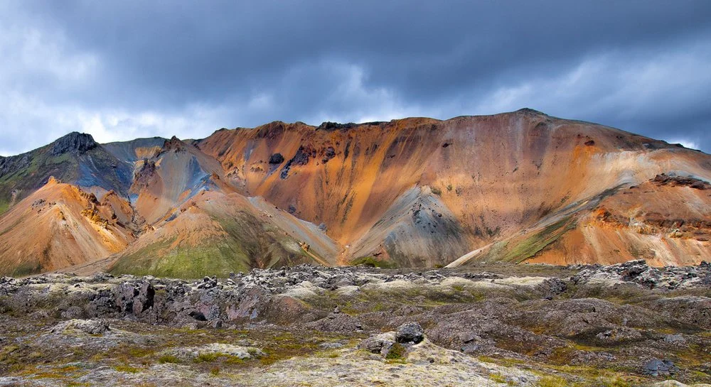
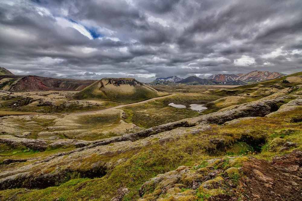
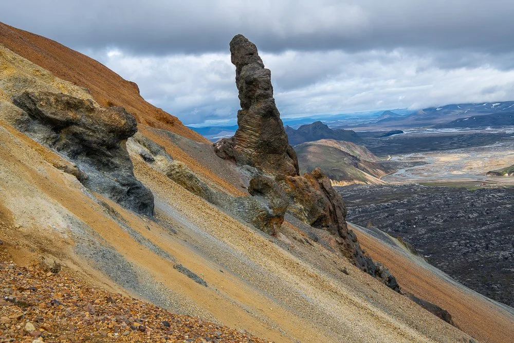
Landmannalaugar Gallery
Remarkably colorful mountains represent the valley of Landmannalaugar. The rich colors of the slopes strike an outstanding contrast with the glittering lava fields. It’s located in the Southern Highlands within the Fjallabak Nature Reserve.
From Reykjavík, it is about a 3-hour drive (112 mi. / 180 km) to Landmannalaugar. <Directions


Sources: wikipedi.orgNo copyright infringement is intended on this website by travelwildnow.com